Why strategic Baramulla-Uri railway line project has run into a hiccup
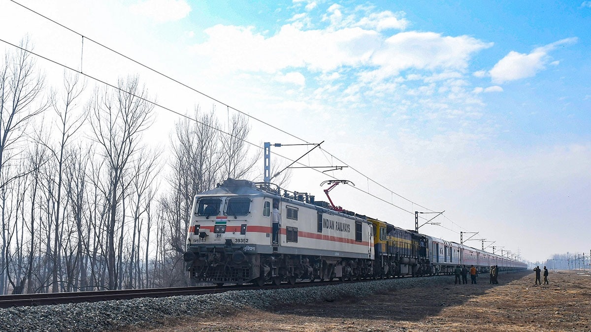
The proposed Baramulla-Uri railway project in Jammu and Kashmir has run into a snag of sorts after the legislative assembly secretariat admitted a private member’s resolution seeking to keep a key stretch of the alignment in abeyance.
The resolution, moved by National Conference MLA from Baramulla, Javid Hassan Baig, calls for a comprehensive and independent geological, geotechnical and seismic assessment of the project alignment before further progress.
The roughly 46-km-long single broad-gauge line is planned as an extension of the Udhampur-Srinagar-Baramulla Rail Link from the existing terminus at Baramulla town to the border town of Uri, close to the Line of Control (LoC). Authorities completed the survey and detailed project report by late 2025. The proposed route passes through Sheeri, Gantmulla, Boniyar, Limber and other locations, requiring fresh land acquisition as well as road overbridges and underbridges.
The resolution has come even as local opposition has grown steadily because the alignment cuts through old settled habitations, bisects villages and traverses precious orchard land and fragile Karewa terrain as it crosses the historic Baramulla town.
Residents and civil society groups, in their representation before the local administration and railway authorities, have repeatedly argued that while strategic rail connectivity is welcome, alternative routes through less populated or vacant land should be prioritised, accompanied by meaningful consultation with stakeholders.It is amidst this backdrop that the J&K legislative assembly secretariat admitted a private member’s resolution seeking to change the alignment of the proposed railway line. The resolution, now part of the business of the ongoing autumn session of the assembly, seeks to keep the proposed alignment of the railway line from Kanispora towards Khanpora/Sheeri localities in north Kashmir in “abeyance” pending a comprehensive, independent geological, geotechnical and seismic assessment of the corridor.
“The resolution calls for a detailed evaluation of slope stability, soil bearing capacity, liquefaction potential, seismic vulnerability, drainage conditions and landslide susceptibility, with finalisation only after competent authorities certify long-term structural suitability and safety,” Baig told INDIA TODAY.
Kashmir lies amidst major geological lineaments and fault systems in the Himalayas, including the Main Boundary Thrust (Pir Panjal Thrust), the Main Central Thrust and the Zanskar Thrust. A recent GPS and geomorphological study by scientists from the Department of Earth Sciences, University of Kashmir, revealed active vertical crustal movements: average land uplift in the southern and southeastern parts of the Kashmir Valley (including Tral and Kulgam) and subsidence along the northern and northwestern edges (Uri and Bandipora). The findings point to an active normal fault running northeast-southwest across the Valley, transverse to the major thrust faults.
Baig warned that the project would turn out to be an “environmental and ecological disaster” if it is carried out without geological, geotechnical and seismic assessments. “The stretch from Kanispora to Khanpora, through which the line is proposed, consists of fragile Karewa lands and is a known sinking area. The railway authorities, including the railway minister, should ascertain these facts and ensure the long-term sustainability of the project before executing it,” he said.
Baig added that he would raise the issue during the ongoing autumn session of the J&K assembly and personally represent the matter before the railway minister in October once the session concludes. He claimed the support of a majority of legislators from north Kashmir on the issue.
“Public projects should serve the common good. The authorities should give proper consideration to local and genuine concerns before going ahead with the railway project,” Baig said, noting that the proposed line also passes through a seismically active zone.
The current resolution follows earlier local concerns that parts of the alignment could cut through the historical Baramulla Degree College grounds and densely populated residential pockets in and around Baramulla town, including Sherwani Colony, Jetty Khawajabagh and Fatehpora. These fears centre on large-scale displacement, demolition of homes and disruption of community infrastructure.
Beyond its potential economic benefits for trade and tourism, the Baramulla-Uri corridor is primarily intended to support military logistics near strategic army establishments that serve as bases for forward troops deployed along the LoC in a sector known for infiltration bids by militants from Pakistan. Once completed, the line is expected to provide all-weather strategic connectivity and enable faster mobilisation and deployment of troops and equipment along the LoC.
A parallel episode unfolded earlier in south Kashmir, where the government shelved plans for two proposed railway corridors: Anantnag-Bijbehara-Pahalgam and Awantipora (Kakapora)-Shopian (and related extensions). Surveys had already been undertaken by the railway authorities, but the projects faced strong opposition from apple growers and residents in the horticulture belt of Anantnag, Shopian and Pulwama. The locals, particularly apple growers, argued that the alignments would require felling large numbers of fruit trees and acquiring scarce fertile orchard land that forms the backbone of the regional economy.
Owing to sustained protests, representations by farmers, political leaders and the J&K administration, the Centre in early 2026 put these projects on hold or dropped them as “infeasible”, citing the risk of damage to orchards.
As more land continues to be acquired for infrastructure projects across Kashmir, pressure on the region’s limited land resources has intensified. Farmers are losing precious agricultural land to new road networks, highway expansions and railway corridor extensions.
Official data shows that approximately 371.242 hectares were acquired for the expansion and related works of the Srinagar-Qazigund section of the national highway. Another 96.15 hectares were projected for acquisition for the four-laning of the 55-km Srinagar-Baramulla stretch, including 57.553 hectares specifically earmarked for the Pattan and Baramulla bypasses. For the full 272-km-long Udhampur-Srinagar-Baramulla Rail Link project, authorities acquired 1,836.19 hectares, of which 1,559.48 hectares was private land and 276.71 hectares government land, according to figures shared in Parliament in 2025.
Against this backdrop, the assembly resolution and the earlier shelving of south Kashmir railway corridors reflect a consistent local demand across Kashmir: development that respects land scarcity, livelihoods rooted in horticulture, residential stability and the geological realities of a fragile Himalayan landscape. The main argument is that strategic connectivity remains valued only when alignments are chosen and certified through full scientific and community scrutiny.