The Super El Niño has officially arrived - and already brought weather chaos with it - The Independent
Want to bookmark your favourite articles and stories to read or reference later? Start your Independent Membership today.
The super El Niño is officially here, NOAA's Climate Prediction Center announced Thursday.
Water temperatures in the Pacific Ocean reached the threshold needed for the designation, rising to at least 0.5 of a degree Celsius (0.9 of a degree Fahrenheit) above average for three consecutive months. The natural climate pattern has been in effect since late spring, leading to historic flooding in the southern U.S. and impacting massive ocean swells along coastlines.
But the U.S. hasn’t seen the worst of its impacts yet, with more coming through the spring.
“El Niño continues to strengthen, with a strong-to-very strong El Niño likely through January-March 2027,” NOAA said.
This weekend, Americans from coast to coast are facing wet weather. A Pacific storm is expected to dump more rain on the West as a nor’easter affected by the subtropical jet stream continues to hammer the Northeast.
El Niño makes conditions for major storms - including nor’easters - more likely and increased storm activity is anticipated early next year, FOX Weather says.
“This El Niño winter may feature more than twice the normal amount of strong East Coast storms, with 19 forecast compared to a normal of nine by ECMWF,” Ben Knoll, a meteorologist, said Thursday on social media.
The El Niño is a climate pattern that occurs when east-to-west trade winds weaken over the Pacific, allowing warm water to shift eastward.
That shift is what fuels more storms and clouds over the region that can cause ripple effects through the global atmosphere.
These events occur every two to seven years, and there are four different strength levels, ranging from “weak” to “very strong.” This year’s El Niño is expected to be among the strongest ever, due to heat in the ocean fueled by human-caused climate change.
“What is different now is that they arrive on top of an ocean that is already warmer than it used to be, so the same event pushes temperatures and sea level higher than it would have in the past,” Kristen Davis, an associate professor at Stanford University, explained in October.
The last time the El Niño was this strong was in 1877, when a global famine killed more than 50 million people.
Americans are already seeing the impacts of this El Niño throughout the nation.
Sea surface temperatures along the California coast are 8 to 10 degrees Fahrenheit higher than average, ”shattering records,” according to climatologist Daniel Swain.
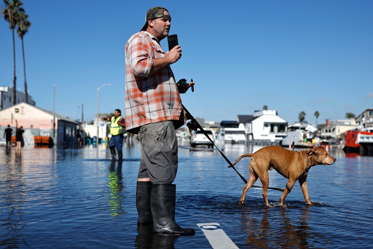
The high Pacific temperatures have resulted in boosted sea levels and energy waves, bringing massive coastal flooding to the Golden State weeks ahead of this month’s high “king” tides.
Warm waters are also shifting what happens below the surface, too, shifting populations of marine life hundreds of miles beyond their normal range. While that’s been great for scientists and ocean-lovers to see, it’s also resulted in the starving deaths of thousands of seabirds that are no longer able to reach their food.
In the southern U.S., El Niño has also contributed to deadly flooding rains.
In Arizona, 73-year-old Williams Singavarapu, was found dead this month after he fell into floodwaters that entered a drainage tunnel, according to FOX 10 in Phoenix. Another man, 63-year-old Benny Sutton, Jr., was also killed after his truck was swept away by floodwaters last week, the Yavapai County Sheriff’s Office said.
There has been some good to come of El Niño. Following the worst spring drought on record in the U.S., water levels in Lake Powell - the country’s second-largest reservoir - rose 20 feet after reaching a record low.
“That’s somewhat of an unexpected boost from Mother Nature,” Martin Hoerling, a climate scientist and hydrologist at the University of Colorado, Boulder, told The Associated Press.
Though Lake Powell is still 13 feet lower than the same time last year, Swain wrote.