Powerful Heat Dome Hits US: 12 States Face Weather Alerts - Newsweek
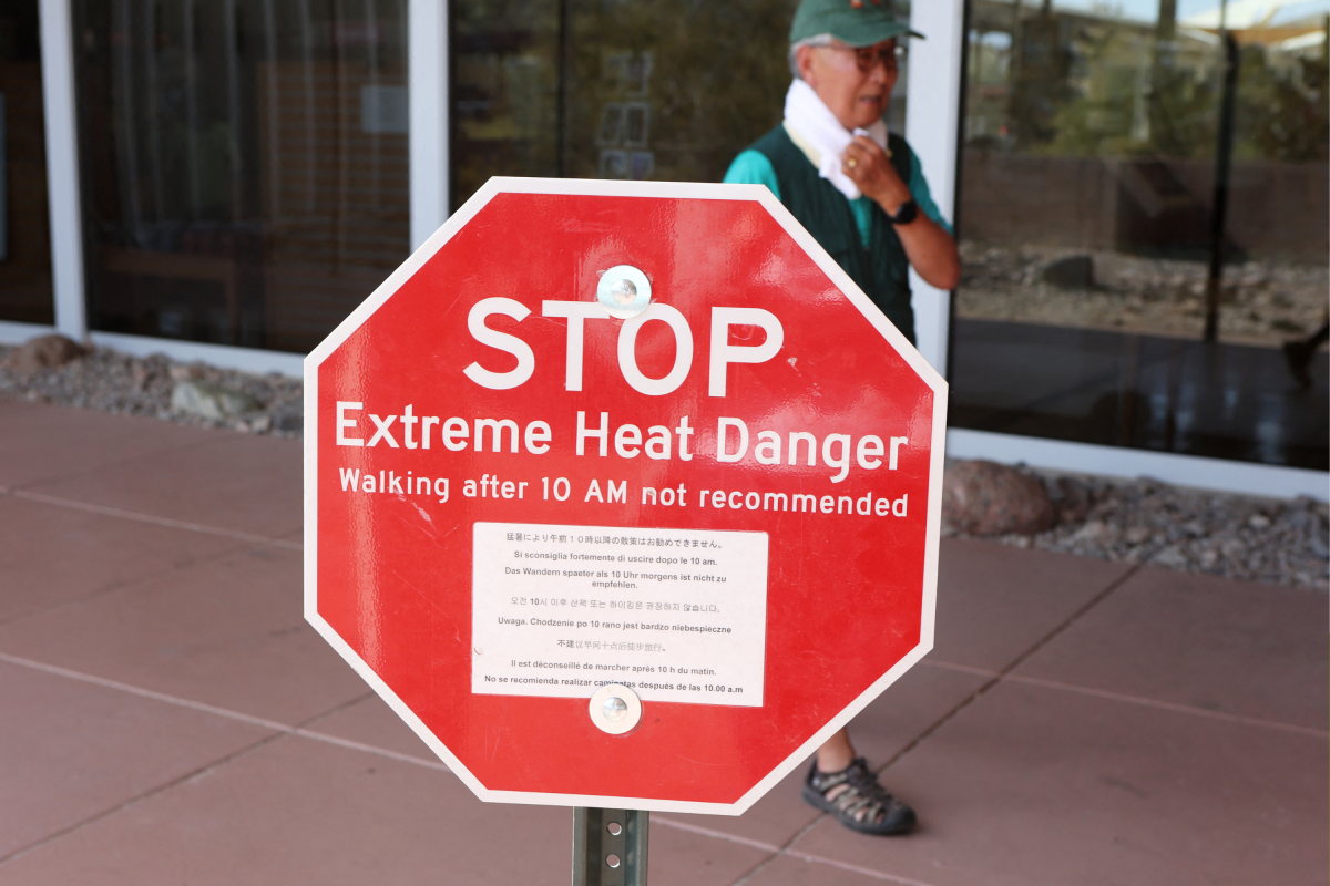
A powerful heat dome is bearing down on several south-central and mid-South regions of the United States starting September 16, bringing potentially “record-challenging” temperatures and dangerous humidity to at least 12 states.
"Over 40 million people are projected to face at least a Moderate risk of heat-related impacts on Wednesday, with 26 million under Extreme risk," Amanda Reinhart and Bob Oravec, meteorologists with NOAA's Weather Prediction Center, told Newsweek on Wednesday.
"At Major to Extreme HeatRisk levels, severe heat stress can affect anyone lacking access to effective cooling or hydration," Reinhart and Oravec warned. The pair noted, "While late-summer heat events are not uncommon across the region in mid-September, the ongoing episode is notable for its exceptional persistence and elevated overnight lows, particularly in North Texas."
"The Dallas-Fort Worth metroplex is experiencing unseasonably warm overnight minimum temperatures alongside a historic multi-week stretch of heat, achieving its highest 30-day average high temperature on record," they said.
The NWS Weather Prediction Center (WPC) said an “upper-level high” associated with a “persistent heat dome” remains firmly established across the South.
The WPC expected temperatures to reach the upper 90s and lower 100s from the Southern Plains into the lower Mississippi Valley, potentially challenging daily records. Meanwhile, areas north of a slow-moving front across the Central Plains and Midwest could experience highs only in the upper 60s and low 70s, creating what WPC forecasters have described as a “pronounced north-south temperature contrast.”
"While the spatial coverage of the heat will gradually contract beginning Thursday, hazardous heat conditions will persist into early next week, concentrating primarily across Southeast and South Texas, as well as portions of the Central Gulf Coast," Reinhart and Oravec said.
An advisory issued by the NWS in Tulsa, Oklahoma, said heat index values (how hot it actually feels when air temperature and humidity are combined) could reach up to 107 degrees Fahrenheit across eastern, northeastern and southeastern Oklahoma and parts of northwestern and west-central Arkansas through Wednesday.
"The primary corridor of greatest heat risk extends from South and Southeast Texas northeastward through the Lower to Middle Mississippi Valley and into the Tennessee Valley," Reinhart and Oravec said, adding, "Surrounding areas, including portions of the Ohio Valley and the Southeastern U.S., will experience elevated temperatures that pose an increased health threat, particularly to heat-sensitive and at-risk populations.
A separate advisory covered southeastern Kansas and a broad section of southern Missouri, including Fort Scott, Joplin, Springfield, Branson, Lebanon, Rolla and Lake of the Ozarks communities, where temperatures could reach around 105 degrees from Wednesday through to Friday. In northeastern Texas, the forecast for Texarkana called for a high near 109 degrees during the hottest parts of Wednesday. Areas in and around central Mississippi, southeast Arkansas, and northeast Louisiana should brace for temperatures up to 110 degrees throughout Wednesday.
“High temperatures reaching into the upper 90s to lower 100s will challenge daily records from the Southern Plains to the lower Mississippi Valley where Heat Advisories remain in effect,” WPC forecasters said, warning that the hazardous heat was likely to remain across the South through the week as the weather front that separates cooler northern air from hotter southern air is expected to move north, allowing dangerous heat to linger across much of the South.
"Widespread potential for daily temperature records to be tied or broken exists from Texas northeastward through the Lower to Middle Mississippi and Tennessee Valleys," Reinhart and Oravec told Newsweek.
"Forecast afternoon maximums and overnight minimum temperatures are expected to approach or exceed historical thresholds through Saturday, with some of these records potentially persisting into Sunday," they said. "These elevated nighttime lows will prevent adequate relief, significantly increasing the overall heat stress."
A heat dome forms when a large area of high pressure becomes stuck over a region. The system traps hot air near the ground, while clear skies and bright sunshine keep temperatures rising day after day after day.
The National Environmental Satellite, Data, and Information Service (NESDIS) explains that the weather system acts like a cap or a lid over the atmosphere, stopping warm air near the surface from rising and disappearing. Because these weather patterns can move slowly, heat can accumulate for days or sometimes weeks.
High humidity makes a heat dome more hazardous because it limits sweat evaporation, one of the body’s main ways to cool itself.
The NWS says that when air temperatures reach around 95 degrees, the body becomes increasingly dependent on sweat evaporation to release heat. Humid air can interfere with that process and cause the internal body temperature to rise.
The Centers for Disease Control and Prevention (CDC) says heat waves are among the leading causes of weather-related deaths in the United States, and estimates that extreme heat kills approximately 1,220 people in the U.S. each year.
Heat exposure can lead to conditions like heat exhaustion and heatstroke, as well as cardiovascular and respiratory complications, kidney failure, and electrolyte imbalances.
Older adults, children, pregnant women, outdoor workers, athletes, and people with existing heart or lung conditions are the most vulnerable and face the highest risks.
The CDC recommends staying in an air-conditioned building or using a public cooling center if home air conditioning isn’t available. People should drink water regularly rather than waiting until they feel thirsty, wear light and loose-fitting clothing, and move intense outdoor activity to the early morning or evening when it’s usually cooler.
"Because Extreme HeatRisk represents rare, multi-day heat episodes without adequate overnight relief, cumulative physiological stress builds rapidly," Reinhart and Oravec told Newsweek. "High-risk groups—including older adults, infants and children, pregnant women, outdoor workers, and individuals with chronic medical conditions—must take immediate protective action to prevent heat-related illness."
Residents should also check on older relatives and neighbors, never leave children or animals inside parked vehicles, and monitor local forecasts because expected heat-index values can change quickly.
Confusion, fainting, loss of consciousness or an extremely high body temperature can be signs of heatstroke, which is a medical emergency. Anyone experiencing those symptoms should be moved to a cooler location while the emergency services are called.
Newsweek’s reporters and editors used Martyn, our AI assistant, to produce this story. Learn more about Martyn here.
Contact Newsweek editors on this story: Rebecca Flood and Sam Wilson.