
Palawan town gets updated map showing WPS islands, other features
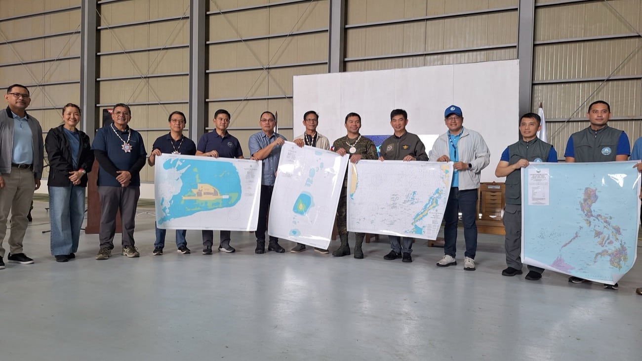
Presidential Assistant for Maritime Concerns Andres Centino, together with National Anti-Poverty Commission chairperson and lead convenor Emmanuel Pacquiao, National Maritime Council spokesperson Alexander Lopez and representatives from the National Mapping and Resource Information Authority present copies of the updated maps to Kalayaan, Palawan Mayor Beltzasar Alindogan on Sept. 25, 2026. — Photo by Geraldford Ticke PAGASA ISLAND, Palawan — The local government of this island town in Palawan province, located in the West Philippine Sea (WPS), received a boost to its presence in the region after receiving an updated chart and map of its component islands and other features during the celebration of the Maritime and Archipelagic Nation Awareness Month (Mana Mo) here Friday, Sept. 25.
The celebration was led by Presidential Assistant for Maritime Concerns Andres Centino, together with National Anti-Poverty Commission (NAPC) chairperson and lead convenor Emmanuel Pacquiao, National Maritime Council spokesperson Alexander Lopez and representatives from the National Mapping and Resource Information Authority (Namria).
Centino, Pacquiao, Lopez and Namria officials presented copies of the updated maps to Kalayaan Mayor Beltzasar Alindogan.
The updated map information includes water depths and island formations in the WPS.
Centino said many changes have occurred in the area and that its previous maps, which are more than 10 years old, need to be updated.
“We witnessed the handover of the updated chart of Kalayaan Island because our map is already old and needs to be updated. Because of the weather, perhaps, and the waters, the contour of the island has changed,” Centino said, speaking in a mix of English and Filipino.
Asked about China Coast Guard vessels and other Chinese maritime militia vessels that can be seen near Pagasa Island, Centino brushed off their presence as “insignificant.”
“What’s important is we are here in Pagasa Island. We are here to witness that there is governance in this part of the Philippines. We have a mayor here, we have local government officials. We have local residents here, we have school children here with teachers. We have a clinic, we have soldiers protecting our sovereign territory,” he told journalists.
“They sail everywhere, but the important thing is we are here asserting our sovereignty,” he added.
Centino also said the celebration of Mana Mo is intended to further raise awareness among Filipinos about the country’s sovereign rights in the WPS, noting that many are still unaware of them.
As part of the activity, Pacquiao handed a P500,000 check to the local government, while the Department of Social Welfare and Development and the Philippine Charity Sweepstakes Office also distributed aid to residents.
Meanwhile, Alindogan expressed gratitude to the national government officials who visited the island.
In an emotional interview, Alindogan said it was the first time that the NAPC had visited the island, and that its presence had an immediate impact on the local government.
Alindogan further said that Pagasa Island, being remote and small with only a handful of residents, often felt neglected, but not anymore on Friday.
The Mana Mo activity, Alindogan said, showed how the national government recognized the role played by Pagasa Island residents in maintaining the country’s sovereignty in the WPS.
The mayor enumerated a list of priority projects that he said were presented to the national government, including a municipal hall building, government operations center, multipurpose evacuation center, water and sewerage system, and drainage system, among others.
Alindogan also said the residents were not concerned about the presence of Chinese vessels near the island, leaving the matter to the national government. He said they are concerned with addressing the needs of the people. /das
For comprehensive coverage, in-depth analysis, visit our special page for West Philippine Sea updates. Stay informed with articles, videos, and expert opinions.


