El Niño strikes again, breaking rain records in San Francisco and along Florida’s Atlantic coast
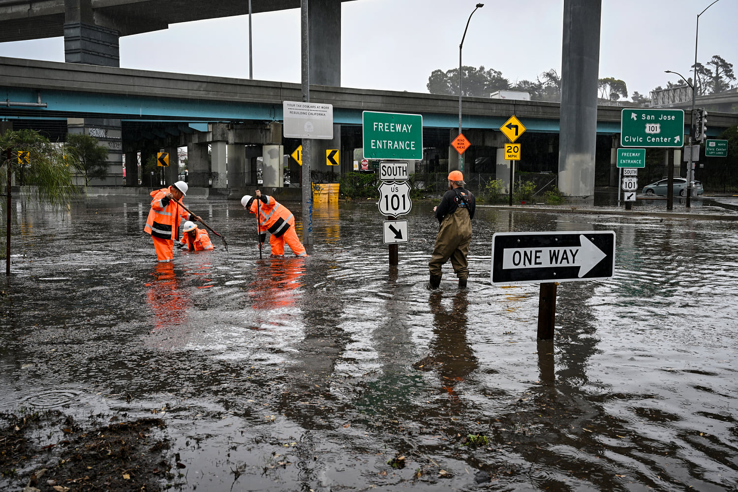
Crews working on Alemany Boulevard at the entrance of Highway 101 during heavy rain in San Francisco on Wednesday.Tayfun Coskun / Anadolu via GettyShareAdd NBC News to GoogleNov. 19, 2026, 6:49 PM ESTBy Evan BushAs storms pound both coasts on Wednesday and Thursday, a strong El Niño is once again rearing its head, breaking rainfall records and causing coastal flooding in California and Florida.
Downtown San Francisco set a new record for daily rainfall Wednesday, at 2.64 inches. The previous record was 2.24 inches on Nov. 18, 1918.
“Yesterday completely smashed those records,” said Anamaria Navarette, a National Weather Service meteorologist in the agency’s San Francisco Bay Area office. “El Niño certainly is playing a part in the event.”
Two waterspouts — a rotating, tornado-like column of moisture over the sea — formed in the San Francisco Bay on Wednesday, and another near Santa Cruz, to the south. Gusty winds downed trees and power lines, while rain soaked burn scars from past wildfires, prompting flash flood warnings.
A car rests in flood water near the 101 freeway on Wednesday in Sausalito, Calif.Benjamin Fanjoy / GettyMeanwhile, on Florida’s Atlantic coast, more than a foot of rain has fallen over the past 48 hours, hitting the same areas that got hammered with historic rainfall just two weeks ago. The prior round of flooding forced ballot boxes to be relocated on Election Day.
Melissa Watson, a National Weather Service meteorologist in Melbourne, Florida, described the last two days in much the same way her San Francisco colleague did: “Quite a few records were broken yesterday,” she said when reached by phone, as alert noises blared in the background. “We are in that strong El Niño pattern.”
Because the storms earlier this month left much of Florida’s Space Coast soggy, the new round of rain sent the region’s flash flood risk rating to its highest category on Thursday.
“It’s not seeping into the earth at all because the soils are completely saturated,” Watson said of the rainwater.
The severe storms on both coasts are thought to be linked to El Niño because the climate pattern intensifies Pacific storms that can hit the West Coast and at the same time rejiggers the southern jet stream to direct more storms toward the Southeast.
Pier 14 at Embarcadero by the Ferry Building during heavy rain in San Francisco on Wednesday.Tayfun Coskun / Anadolu via Getty ImagesData from the National Oceanic and Atmospheric Administration suggests that this season’s El Niño event was the second-biggest on record for the months of August through October, even when ignoring the influence of climate change. NOAA expects the trend to persist through May.
El Niño is a natural pattern that happens when winds near the equator weaken and less cold water rises to the surface in the eastern Pacific Ocean. The pattern drives up global temperatures.
In California, the majority of fall and winter precipitation regardless of El Niño is driven by atmospheric river storms: narrow plumes of moisture from the tropical or subtropical Pacific.
These storms are responsible for more than $1.1 billion in yearly flood damage, on average, according to a 2022 study. About 84% of flood damage in Western states is associated with atmospheric rivers, research suggests.
A law enforcement officer from the Florida Fish and Wildlife Conservation Commission asks a resident if they need help evacuating on Wednesday in Hollywood, Fla.Joe Raedle / GettyAlthough atmospheric rivers are not necessarily more frequent in California during El Niño years, they can pack a stiffer punch because the warm Pacific water provides more fuel to storms.
Off the coast of Monterrey, California, sea surface temperatures were about 12 degrees Fahrenheit warmer than average, Navarette said.
“A lot of the moisture that we were seeing surging on through yesterday was definitely amplified by those warm ocean temperatures,” she said.
In the Southeast and Gulf Coast, El Niño typically lowers temperatures, but it draws storm tracks farther south.
Daytona Beach saw nearly 5.8 inches of rain on Wednesday, breaking its previous daily rainfall record by more than 5 inches, Watson said. Some 11 million Floridians were under a flood watch Thursday morning.
An apartment complex resident peers out at her flooded street after heavy rains, in Hollywood, Fla., on Wednesday.Rebecca Blackwell / AP Melbourne officials opened an emergency shelter at a community center. Gov. Ron DeSantis deployed hundreds of National and State Guard personnel, highway patrollers and wildlife officers to respond to the flooding.
On Thursday, rainfall rates were forecast to get as high as 4 inches per hour in parts of Florida. By Saturday, forecasters expect 4 to 8 inches of rain along the coast, with 12 to 15 inches possible in some localized areas. More flooding is likely.
Evan Bush is a science reporter for NBC News.